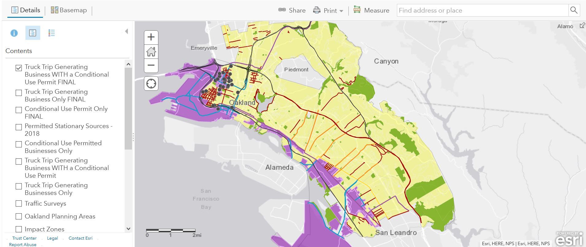
Zoning and Air Pollution Mapping Tool

The goal of the Zoning and Air Pollution Mapping Tool is to identify patterns in poor health, air pollution and the location of industrial and residential uses. The tool provides a data-driven context for understanding how people in different Oakland neighborhoods experience disparities, and thus, where the priorities lie. Together with inclusive community engagement, this information can provide the foundation for recommendations that address long-standing environmental justice issues.
Key feature in the interactive Zoning and Air Pollution Mapping Tool:
- Air Pollution Health Index
- Priority Neighborhoods (defined by the Oak DOT Equity Tool)
- Zoning
- Truck
Attracting Businesses (including identifying which businesses are
"non-conforming" and which businesses have conditional use permits)
- Truck Routes, Freeways and Major Corridors
- Air District-permitted Pollution-Emitting Equipment
Research & Existing Conditions
- Research Compilation Presentation (Land Use Tools to Address Emissions; Health Disparities in Oakland; Industrial Lands Assessment; Zoning Regulations Overview)
- Database of Truck Attracting Businesses
About
State legislation (AB 617) directs air regulators to work with communities facing air pollution and poor health to develop solutions. Adopted in 2019 by the Bay Area Air Quality Management District, the WOCAP includes community-based emissions reductions strategies with implementation authority falling within a spectrum of public agencies including the California Air Resource Board, Bay Area Air Quality Management District, Caltrans, public transit agencies, the Port of Oakland, and the City of Oakland.
City staff participate in the Steering Committee focused on implementing the strategies contained in the WOCAP. The Steering Committee is comprised of community members, agency representatives, non-profits and academic institutions. Staff representing the departments responsible for the various strategies participate in the monthly Steering Committee Subcommittees including: Land Use, Transit, Bike & Walk and Health and Living Buffers.
For more information, visit the Air District's WOCAP website. The California Air Resources Board website contains additional information about the AB 617 program.
Staff Contacts:
Laura Kaminski, Strategic Planning Manager, Planning & Building Department
Danielle Makous, Sustainability Analyst, Environmental Services Division, Public Works (Health & Living Buffers Subcommittee)
Lily MacIver, Management Intern, Oakland Department of Transportation (Transit, Bike & Walk Subcommittee)
